Free historical maps of Germany and Europe

It is mildly embarrassing to come across a great resource that is hosted within one’s own institution by accident (read: google). Unwittingly googling one’s own publications is definitively worse, but that is not the point. Nonetheless, I was happy to stumble upon the Institute of European History’s digital map server when I needed to illustrate my point about territorial cleavages in Germany. The site has a slightly dusty look and uses gifs for previews, but the licence is more than generous and the coverage and quality are impressive. If you ever need a map of Hessen-Kassel’s administrative structures in 1821, look no further. The only thing that is missing (as far as I can tell) are shapefiles, but if you are serious about GIS applications, you can convert/georeference the postscript files. For lecture slides, the gifs should suffice anyway.

The Extreme Right Bibliography has a new home

As some of you might have noticed, I have recently made some changes to my site. The idea was to simplify its administration and to streamline its design. Predictably, the only thing that really took off was the number of 404 errors. To quote the central theorem of policy analysis, all innovations make things worse,…

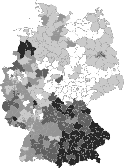
Mapping local deviations from regional voting patterns in Germany

Mapping local deviations from regional voting patterns in Germany 1

Political Science is the magpie amongst the social sciences, which borrows heavily from other disciplines. These days, many political scientists are actually failed economists (even more failed economists are actually economists, however). I used to think of myself as a failed sociologist, but reading the proofs it dawned on me that I might actually aspire to become a failed geographer.

Easy Google geocoding in Stata

For the un-initiated: Geocoding is the fine art of converting addresses into geographical coordinates (longitude and latitude). Thanks to Google and some other providers like OpenStreeMap, this is now a relatively painless process. But when one needs more than a few addresses geocoded, one does not rely on pointing-and-clicking. One needs an API, i.e. a software library that makes the service accessible through R, Python or some other programming language.
geocode is a user-written Stata command that gives access to Googles API from within Stata. It takes a variable containing address strings and returns two new variables containing the latitude/longitude information

Putting candidates in their place with R

Counting the number of mainstream candidates living in a constituency is a point-in-polygon problem: each candidate is a co-ordinate enclosed by a constituency boundary. R function overlay from package sp carries out the relevant operation. Counting candidates and mapping their number is easy if you remember one thing: VECTORISATION

Islam ‘does not belong in Germany’?

It’s silly season all over again: On the eve of this year’s ‘German Islam Conference’, Volker Kauder, head of the Christian Democrats in parliament and one of Merkel’s key alleys, declared that ‘Islam is not part of our tradition and identity in Germany and so does not belong in Germany.’. As an aside, he added that Muslims do belong to Germany and enjoy their full rights as citizens. Phew!

English Voters Prefer Local Candidates, Ceteris Paribus

The effect of geographical distance between candidate and voter on vote likelihood in the UK is essentially untested. In systems where constituency representatives vie for local inhabitants’ support in elections, candidates living closer to a voter would be expected to have a greater probability of receiving that individual’s support, other things being equal. In this paper, we present a first test of this concept using constituency data (specifically, notice of poll address data) from the British General Election of 2010 and the British Election Survey, together with geographical data from Ordnance Survey and Royal Mail, to test the hypothesis that candidate distance matters in voters’ choice of candidate. Using a conditional logit model, we find that the distance between voter and candidates from the three main parties (Conservative, Labour and Liberal Democrat) matters in English constituencies, even when controlling for strong predictors of vote-choice, such as party feeling and incumbency advantage.